Cities have always lived between regulation and imagination. Zoning codes tell us what can be built; design tells us why it matters. For decades, these two worlds met only on paper — plans, spreadsheets, and diagrams that described a city but rarely let people see it.
Today, visualization tools like AIRIlab are changing that balance. By combining architectural intelligence with fast, AI-assisted rendering, planners and designers can now translate policy into imagery — helping everyone understand what the future city might actually look like.
Why Visualizing Policy Matters
A zoning code can define a building’s height, setback, and use. But it can’t describe how that rule feels on a summer afternoon or how light falls between buildings.
Using AIRIlab’s rendering and atmosphere controls, planners can create context views that express scale, openness, and livability. Each visual keeps the precision of regulation but adds the empathy of design — turning technical data into shared understanding.
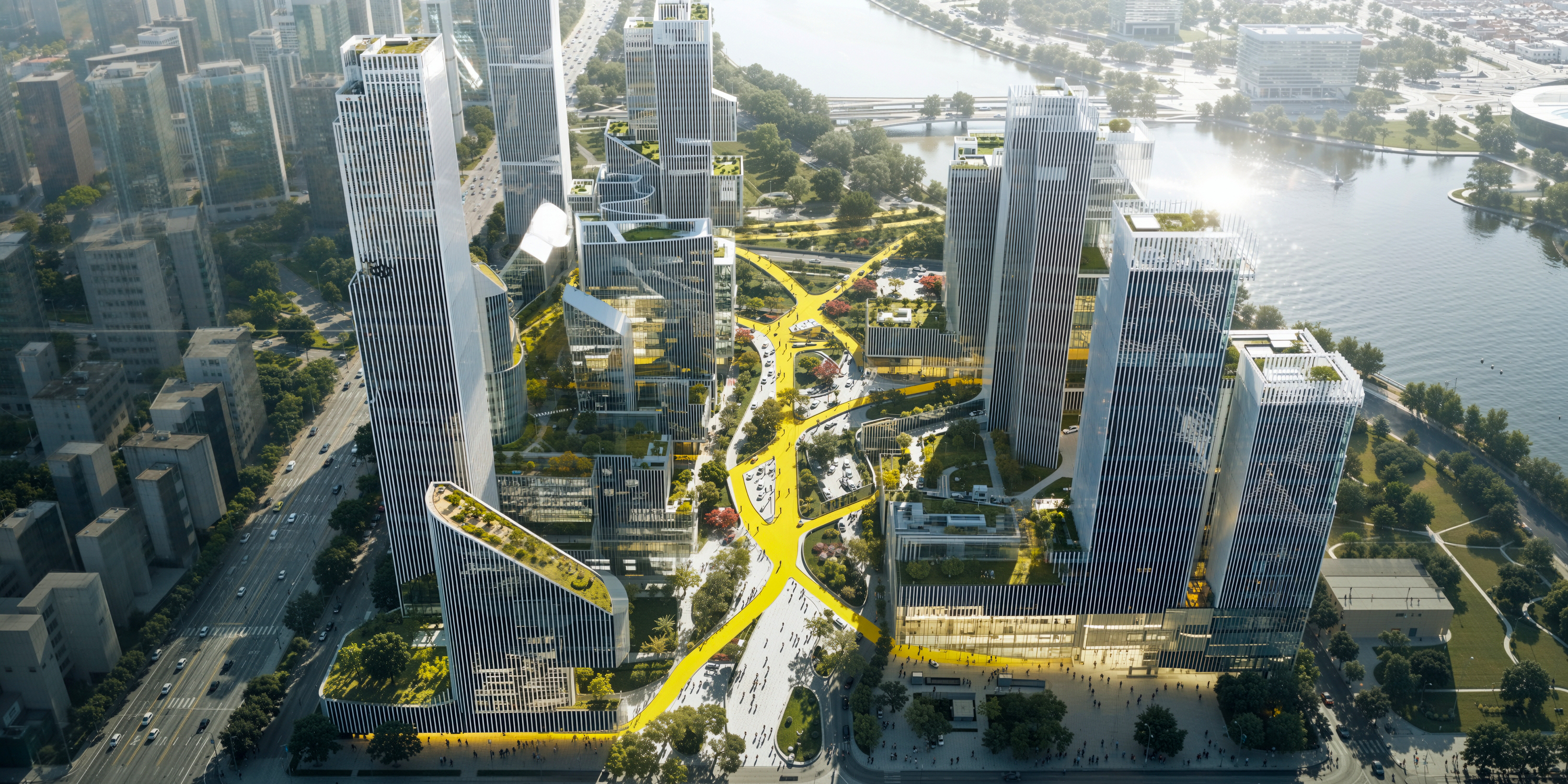
Making the Abstract Visible
Planning meetings often rely on dense reports that only specialists can read. When AIRIlab is part of the workflow, those same reports can include clear, believable visuals generated directly from base massing or sketches.
- Render provides realistic spatial context.
- Atmosphere Swift adjusts tone and lighting to communicate time of day or season.
- Smart Edit allows quick refinements — changing surface tone, softening shadows, or brightening open areas — without re-rendering an entire scene.
These tools don’t predict a city’s future; they illustrate intent with honesty and clarity.
Collaboration in the Cloud
Urban planning involves multiple voices — architects, landscape designers, transport engineers, and public officials. Because AIRIlab runs entirely in the browser, everyone can view and comment on the same image set without installing extra software or exchanging large files.
One team can adjust the streetscape while another reviews façade texture; all changes remain visible in real time. This accessibility shortens review cycles and keeps visual language consistent across agencies and consultants.
Speed That Enables Dialogue
Planning discussions move quickly. Traditional visualization pipelines often can’t keep up. With AI-accelerated rendering, AIRIlab reduces turnaround from days to hours.
Planners can present multiple scenarios — denser housing, additional green corridors, altered street widths — within the same session. That speed doesn’t automate decision-making; it makes discussion possible while the ideas are still alive.
A Bridge to the Digital-Twin Era
The term digital twin describes a digital representation of physical assets. While AIRIlab doesn’t create full, data-driven city twins, it provides their most visible layer: credible architectural imagery.
Its visuals can complement broader urban-information models by showing how policy translates into human-scale form. In this way, AIRIlab acts as the storytelling surface of the digital city — accurate, aesthetic, and easy to share.
From Codes to Conversations
When complex zoning language becomes imagery, public participation improves. Citizens can respond to what they see, not what they have to interpret.
A planner can show two options for a redevelopment block: one following existing setbacks, another with adjusted open-space ratios. Both are rendered through AIRIlab with consistent tone and lighting, allowing stakeholders to compare impacts directly.
It turns regulation into conversation — a shift from documents to dialogue.
Urban Sustainability, Seen Clearly
Every rule in planning affects the environment: how much light reaches the street, how trees are placed, how surfaces reflect heat.
Through controlled lighting and realistic materials, AIRIlab helps visualize these relationships without claiming to simulate them scientifically.
Designers can show shaded pedestrian zones, permeable pavements, or rooftop greens in credible, high-resolution imagery that communicates environmental thinking visually and truthfully.
Precision in Every Pixel
Accuracy matters in planning visuals. AIRIlab’s Smart Edit ensures that small updates — tone correction, lighting refinement, façade detailing — can be made instantly while maintaining geometric integrity.
The result is consistency across every render, from concept massing to final presentation. That reliability builds confidence: the city shown in the image reflects the intent of the plan, not a stylized version of it.
The Road Ahead
Urban planning will always rely on data and policy. But its future depends on understanding — and understanding grows through visualization.
AIRIlab’s role is to make that visualization accessible, accurate, and human. It doesn’t automate planning; it amplifies the planner’s ability to communicate.
By turning zoning codes into believable imagery and linking design teams through the cloud, it helps cities plan with transparency and empathy.
Conclusion
From static zoning maps to visually rich digital contexts, planning is evolving into a discipline of clarity. AIRIlab gives that clarity form — helping planners, architects, and citizens share a common vision before the first foundation is laid.
It’s not about predicting the city of tomorrow. It’s about seeing it together, today.